|
|
|
ADVERTISEMENTS
|
|
PREMIUM
- HAPPY HOLIDAYS!
- Siliconeer Mobile App - Download Now
- Siliconeer - Multimedia Magazine - email-Subscription
- Avex Funding: Home Loans
- Comcast Xfinity Triple Play Voice - Internet - TV
- AKSHAY PATRA - Bay Area Event - Sat. Dec 6
- Calcoast Mortgage - Home Loans
- New Homes in Silicon Valley: City Ventures - Loden Place - Morgan Hill
- Bombay to Goa Restaurant, Sunnyvale
- Buying, Sellling Real Estate in Fremont, SF Bay Area, CA - Happy Living 4U - Realtor Ashok K. Gupta & Vijay Shah
- Sunnyvale Hindu Temple: December Events
- ARYA Global Cuisine, Cupertino - New Year's Eve Party - Belly Dancing and more
- Bhindi Jewellers - ROLEX
- Dadi Pariwar USA Foundation - Chappan Bhog - Sunnyvale Temple - Nov 16, 2014 - 1 PM
- India Chaat Cuisine, Sunnyvale
- Matrix Insurance Agency: Obamacare - New Healthcare Insurance Policies, Visitors Insurance and more
- New India Bazar: Groceries: Special Sale
- The Chugh Firm - Attorneys and CPAs
- California Temple Schedules
- Christ Church of India - Mela - Bharath to the Bay
- Taste of India - Fremont
- MILAN Indian Cuisine & Milan Sweet Center, Milpitas
- Shiva's Restaurant, Mountain View
- Indian Holiday Options: Vacation in India
- Sakoon Restaurant, Mountain View
- Bombay Garden Restaurants, SF Bay Area
- Law Offices of Mahesh Bajoria - Labor Law
- Sri Venkatesh Bhavan - Pleasanton - South Indian Food
- Alam Accountancy Corporation - Business & Tax Services
- Chaat Paradise, Mountain View & Fremont
- Chaat House, Fremont & Sunnyvale
- Balaji Temple - December Events
- God's Love
- Kids Castle, Newark Fremont: NEW COUPONS
- Pani Puri Company, Santa Clara
- Pandit Parashar (Astrologer)
- Acharya Krishna Kumar Pandey
- Astrologer Mahendra Swamy
- Raj Palace, San Jose: Six Dollars - 10 Samosas
CLASSIFIEDS
MULTIMEDIA VIDEO
|
|
|
|
|
TECHNOLOGY:
Digitized Mapping: Protecting India's Environment and Forests
Protection of India’s environment and forests requires the processing of large amounts of geographic information as well as numerous levels of bureaucratic approval. Integrating a decision support system with a Geographic Information System – an information management system, dedicated to the analysis of geographic information, that integrates different datasets and provides users with the ability to compare features across spatial datasets with different origins – could improve environmental regulation in India, writes Shashank Srinivasan.
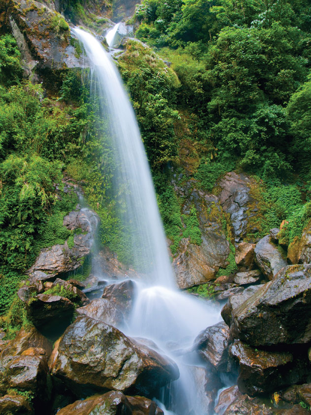
(Above): A waterfall in Sikkim, India, is just one example of the vast environmental wealth the country possesses.
“Technology magnifies human intent and capacity.” – Dr. Kentaro Toyama
Knowledge of the spatial nature of one’s surroundings is essential for resource use, environmental management, allocation of land rights and diplomatic relations with other communities. Obtaining and recording geographic information is an essential component of community functioning. Processing this information and making robust decisions is critical to the continued existence of a community, whether it is a small nomadic tribe or a nation the size of India.
Today, India is in transition; there are numerous independent agents with differing aims and objectives attempting to access the nation’s natural resources. The increased workload on environmental regulatory agencies has led to a profusion of procedures that curtail economic growth and governmental transparency. In particular, the protection of India’s environment and forests requires the processing of large amounts of geographic information as well as numerous levels of bureaucratic approval. Integrating a decision support system with a Geographic Information System (GIS) – an information management system, dedicated to the analysis of geographic information, that integrates different datasets and provides users with the ability to compare features across spatial datasets with different origins – could improve environmental regulation in India.
Traditionally, geographic information was collected by teams of field surveyors, and recorded in physical media in the form of maps. Land-cover data regarding tree cover and agricultural lands, physical features such as mountains and rivers, or even virtual data such as the location and extent of borders and boundaries qualify as geographic information. Surveying, the science of determining the location of points on the earth’s surface, and cartography, the complementary science of creating maps with this information, are ancient fields of study. Teams of surveyors would spend years determining land ownership boundaries and physical features, and highly trained cartographers would record the geographic information of entire communities in the form of detailed maps.
India has a long historical tradition of collecting and recording geographic information. One of the first and largest land surveys was conducted by Sher Shah in the sixteenth century for the purposes of land revenue estimation. The Mughal emperor Aurangzeb duplicated this task in the late seventeenth century and the British Empire continued this exercise, using a system of written records and field maps to establish control over the land they acquired. This exercise of information collection and analysis required trained manpower to process this data, making the method inaccessible to a wider audience. However, this has changed with the invention of satellite-based remote sensing in the last century, which is now an essential tool in the collection of geographic information. Remote sensing, the study of objects from a distance using both passive and active electromagnetic radiation, has automated the surveying method and reduced the time taken to collect this data. Increased computational power and advanced software development have enabled the creation of easily deployable GIS.
There are numerous agencies in India today, both governmental and private, which work on the various applications of remote sensing data. Chief among these applications is the study of the environment for purposes of management, conservation and protection. The Forest Survey of India produces forest cover maps of the country, and other agencies prepare or commission maps of their themes of interest.
Geographic information and environmental protection are inextricably interlinked. The identification and delineation of borders that restrict or permit access to areas, or of boundaries that define ecological extent or wildlife movement, are critical to environmental management. Controlling and containing the environmental impact of human activity requires this information to be easily accessible to environmental regulatory agencies such as the Indian Union Ministry for Environment and Forests (MoEF) and the various State Forest Departments.
Decisions taken by these agencies affect the lives and livelihoods of millions of Indians everyday. Data is obtained from various sources and used to make these crucial decisions; however, these datasets are disaggregated and difficult to visualize in their existing form. There is a strong case to be made for the digitization of India’s environmental information; in a recent judgment, the Supreme Court of India has explicitly recognized this need.
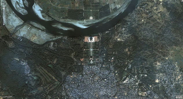
(Above): Sample of a digitized map. The Taj Mahal and its surrounding areas can be seen in this map.
Ideally, the spatial data from an application for environmental or forest clearance would be rapidly entered into the GIS; this could then be compared with other datasets such as forest cover, wildlife habitat, groundwater and distance from protected areas. Since the data from all applications will be contained within the same GIS, the cumulative environmental impact on a specific region will be rapidly estimated. This GIS could be used as a Geospatial Decision Support System (GDSS) to help regulatory agencies make transparent, accurate, reproducible, and robust policy decisions.
Without this GDSS, government agencies will not have access to the best available tools required to enforce the laws of the land. For example, the Goa State Assembly’s Public Accounts Committee recently used freely available satellite imagery from Google Earth to identify a case of illegal mining. An efficient GIS will be able to automatically flag such flagrant violations by simply comparing the relevant datasets; there may be many more similar cases that have just not been brought to light.
The MOLAND (Monitoring Land Use / Cover Dynamics) system maintained by the European Commission’s Joint Research Centre is one example of a functional GDSS. The project has a stated aim of “assessing, monitoring, and modeling the development of urban and regional environments…to support the preparation, definition, and implementation of EU policies and legislation,” and was initiated in 1998. The U.S. Forest Service also uses GDSSs for various purposes; their most recent tool, the November 9, 2011 Forests to Faucets project, “identifies areas that supply surface drinking water, have consumer demand for this water, and are facing significant development threats.” The information from this GDSS can then be incorporated into Forest Action Plans or used with other decision support tools.
Creating this GDSS will be a technical and technological challenge, and could be developed by private agencies, such as Google or Paladin, who have proven expertise in the design and production of such enterprise level software. Indian government agencies such as the National Information Center (NIC), the National Remote Sensing Agency (NRSA) and the various state Space Applications Centers (SAC) may also be able to play leading roles in this process. An alternative production process is through the development of open-source software; an example of this process is the U.S.-Russian government code-a-thon held in September 2011, where teams of programmers competed to create information systems for better governance.
The technologies required to create a comprehensive environmental GDSS exist; implementing them will magnify the capacity and intent of environment regulatory authorities in India. Hopefully, this will result in better protection for India’s environment and forests.
This article first appeared in ‘India in Transition (IiT),’ a publication of the Center for the Advanced Study of India (CASI) of the University of Pennsylvania. All viewpoints, positions, and conclusions expressed in IiT are solely those of the author(s) and not specifically those of CASI. ©2011 Center for the Advanced Study of India and the Trustees of the University of Pennsylvania. All rights reserved. [http://casi.ssc.upenn.edu].
|
 |
Shashank Srinivasan is an independent environmental researcher and cartographer who works with NGOs across India.
|
|
|
|
|
|
|